Digital Design Code
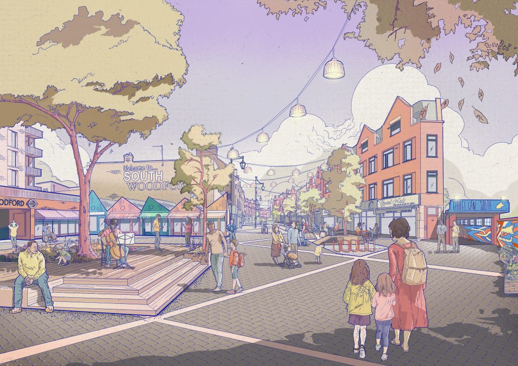
Shaping the Future of SoWo
South Woodford’s Digital Design Code is an interactive tool to help shape high-quality placemaking across the neighbourhood. It provides clear, user-friendly guidance for everyone involved in the planning process, from developers and architects to the local community and council planning officers.
The Design Code’s principles ensure all new development protects and enhances the local area, leading to a healthier, safer and more sustainable South Woodford.
Got a question or want to find out more? Get in touch.
What is a design code?
A design code can be prepared at an area-wide, neighbourhood or site-specific scale. Comprising of a set of design principles to inform future development, design codes can give specific parameters for the development of an individual site or rules to be applied for developments across a wider area. Design codes should be based on effective community engagement and reflect local aspirations for the development of the area.
Why is a design code required?
The Government’s National Planning Policy Framework (NPPF) and the Levelling Up and Regeneration Bill requires all local planning authorities to prepare design codes consistent with the principles set out in the National Design Guide and National Model Design Code, and which reflect local character and design preferences.
What’s the difference between a design guide and a design code?
A design guide is a document providing guidance on how development can be carried out in accordance with good design practice, often produced by a local authority.
A design code is a set of simple, concise, illustrated design requirements that are visual and numerical wherever possible to provide specific, detailed parameters for the physical development of a site or area.
Why are design codes important?
Design codes are important because they provide a framework for creating healthy, safe, green, environmentally responsive, sustainable and distinctive places, with a consistent and high-quality standard of design. This can provide greater certainty for communities about the design of development and bring conversations about design to the start of the planning process, rather than the end.
The built environment has a significant impact on people’s health and wellbeing. It needs to feel safe and secure for all, including those who could be more vulnerable. Creating beautiful places requires a greener approach that supports progress towards our national environmental goals. This means more energy efficient buildings, well designed public spaces, enhancing nature, creating more resilient places and delivering progress towards meeting the net zero carbon target by 2050.
The National Planning Policy Framework (NPPF) advises that early discussion between applicants, the local planning authority and local community about the design and style of emerging schemes is important for clarifying expectations and reconciling local and commercial interests. Applicants should work closely with those affected by their proposals to evolve designs that take into account the views of the community. The NPPF also states that applications that can demonstrate early, proactive and effective engagement with the community should be looked on more favourably than those that cannot.
Does a design code impose a particular style?
The National Planning Policy Framework (NPPF) encourages local authorities to use design codes to help deliver the high quality outcomes for new development. It is important however, that there is a balance between promoting and reinforcing local distinctiveness and allowing for innovation and originality. The geographic coverage, level of detail and degree of prescription should therefore be tailored to the circumstances and scale of change in each place, and should allow a suitable degree of variety.
The NPPF states development that is not well designed should be refused, especially where it fails to reflect local design codes, policies and guidance. Conversely, significant weight should be given to:
- A. Outstanding or innovative designs which promote high levels of sustainability, or help raise the standard of design more generally in an area, so long as they fit in with the overall form and layout of their surroundings.
- B. Development which reflects local design codes, policies and guidance and government guidance on design and/or
Are communities involved in creating design codes?
Whilst landowners and developers may also contribute, the National Planning Policy
Framework (NPPF) is clear that design policies should be developed with local communities, so they reflect local aspirations. When preparing design codes and guides, communities need to be involved in the process in order to gain measurable community support for what is considered appropriate for the scale and location of new development. Design codes should be prepared in light of information about what is popular locally, on the basis of evidence. This will address the ambition in a new planning system to bring democracy forward so that communities decide what good design means locally.
This South Woodford Design Code is a Neighbourhood Forum-led code, specifically focusing on priorities identified by the local community.
What area does it cover?
The South Woodford Neighbourhood Forum (SWNF) area covers the majority of the South Woodford ward, with slight overlap of Churchfields and Wanstead Village. See map >
Resources & Data
Useful documents
Redbridge
- Character Areas
- Characterisation Study
- District Centres
- Housing Design Guide
- Local Plan 2015-2030
- Planning Obligations
- Policies Map
- The Story of Redbridge
London
Maps
Redbridge
- Allotments
- Brownfield Land Register
- Conservation Area
- Green Belt Land
- Listed Buildings (Local)
- Listed Buildings (Statutory)
- Opportunity Sites
- Parks and Open Spaces
London
- 10-Minute Walk
- Air Quality
- Area Profiles
- Google Mobility by Borough
- Green Cover
- Green Infrastructure Focus
- Green Roofs
- Heat Map
- High Street Boundaries
- London Landscape
- London Traffic
- London Traffic Counts Map
- Neighbourhood Perception and Crime Comparator
- Output Area Classification
- Planning Data Map
- Street Trees
- Sustainable Drainage Systems (SuDS)
- Tree Canopy Cover
- Urban Heat Island
Nationwide
- Census
- Green Infrastructure
- Green Space Index 2023
- Green Space Rating
- Open Route Service
- OS Open Greenspace
- Space Syntax OpenMapping
Design Code inspiration and best practice guidance
Planning and Design Codes
- Department for Levelling Up, Housing & Communities (2024), Neighbourhood Planning Design Coding Guidance
- Department for Levelling Up, Housing & Communities (2024), Planning Practice Guidance
- Ministry of Housing, Communities & Local Government (2021), National Design Guide
- Ministry of Housing, Communities & Local Government (2021), National Model Design Code
- Ministry of Housing, Communities & Local Government (2023), National Planning Policy Framework
Greenspace
- Department for Levelling Up, Housing & Communities (2024), Neighbourhood
- CIEEM, Biodiversity Net Gain
- Civic Trees, Specification for semi-mature tree planting for both root-ball and container grown stock
- The Ecology Consultancy/GLA (2017), Urban Greening Factor for London: research report
- Fields in Trust (2020), Guidance for Outdoor Sport and Play: Beyond the Six Acre Standard – England
- Konijnendijk van den Bosch, Prof. C. (2021), Promoting health and wellbeing through urban forests – Introducing the 3-30-300 rule
- Greater London Authority (2008), Living Roofs and Walls Technical Report: Supporting London Plan Policy
- Green Infrastructure Consultancy (2018), Urban Greening Factor Study
- Natural England (2023), Green Infrastructure Standards for England – Summary
- Natural England (2023), Urban Greening Factor for England – Development and Technical Analysis
- NHBC Foundation (2021), Biodiversity in new housing developments: creating wildlife-friendly communities
- University of Surrey (2019), Implementing Green Infrastructure for Air Pollution Abatement: General Recommendations for Management and Plant Species Selection
- Vivid Economics (2017), Natural capital accounts for public green space in London: local authority summaries, p.52
- Ziter, C.D. et al. (2019), Scale-dependent interactions between tree canopy cover and impervious surfaces reduce daytime urban heat during summer
Public Space
- Ziter, C.D. et al. (2019), Scale-dependent interactions between tree canopy cover and impervious surfaces reduce daytime urban heat during summer
- Department for Transport (2007), Manual for Streets
- Landor LINKS (2023), Liveable Neighbourhoods
Walking & Cycling
- Fields in Trust (2020), CHAMPION: The ten-minute walk and why it’s important
- Lambeth Council (2023), Lambeth Kerbside Strategy: Rebalancing priorities for Lambeth streets
- Sustrans (2020), What is a 20-minute neighbourhood?
Amenities
- Greater London Authority (2012), Shaping Neighbourhoods: Play and Informal Recreation
- Sustrans (2020), What is a 20-minute neighbourhood?
- Play Streets, Make it happen on your street
Other
- Secured by Design (SBD)
- Transport for London (TFL) (2021), Sustainable Development Framework